Development of 3D Charts for Fishing
In product management at Raymarine in 2001, it was a never-ending arms race to beat the competition to the next feature and win in the market. While brainstorming next-generation charting features, someone realized we live in a 3D world, but charting was limited to providing 2D simplifications.
Even 20 years ago, gaming graphics proved realistic images could be achieved by a personal computer (PC). In 2001, we had no embedded hardware platforms that could handle the processing needed for realistic 3D charts at any speed, let alone at the speed live navigation requires. PC navigation platforms like Nobeltec, Maptech and Raymarine’s RayTech were available, but PCs were too delicate for most boats.
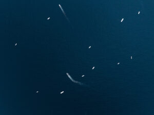
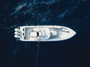
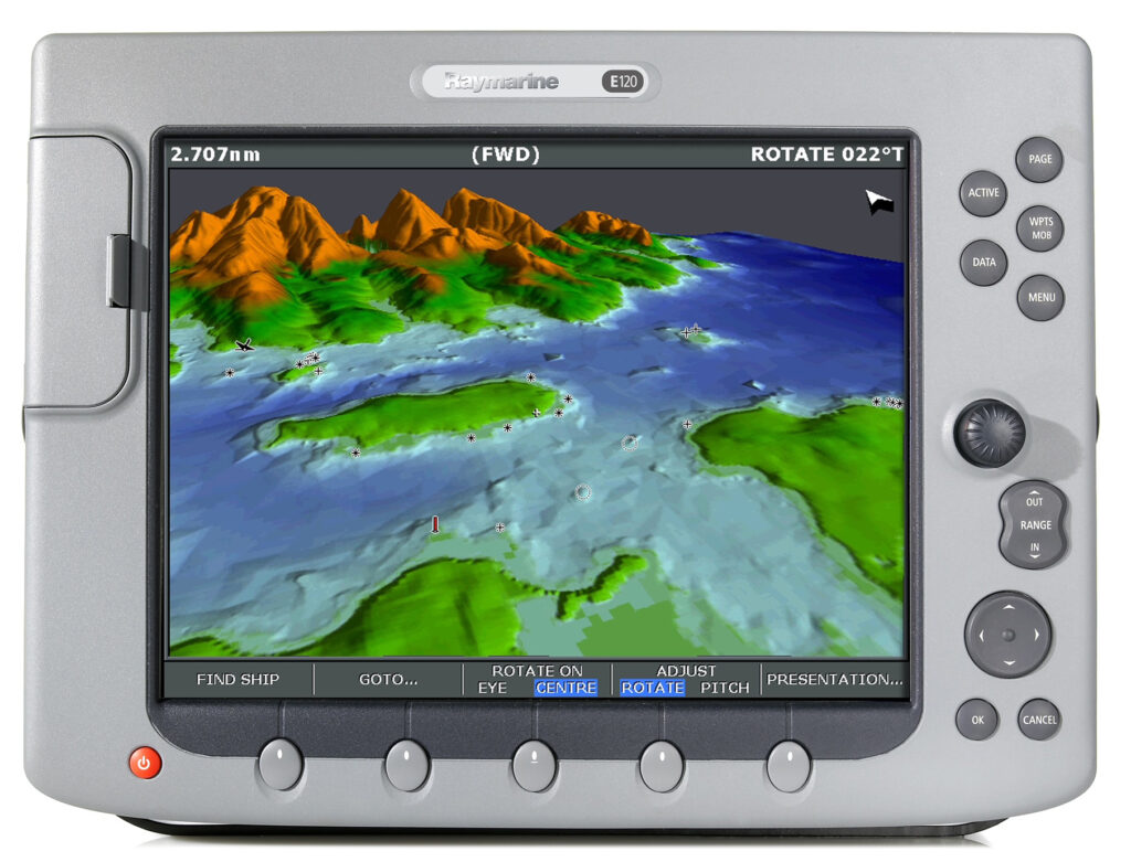
After several discussions with potential suppliers, there was a joint development program with Giuseppe Carnevali, founder of Navionics, to bring the world’s first 3D embedded cartography to chart plotters to help boaters and anglers visualize the water around them. In addition to 3D, aerial images provided insights into channel structures, enabling better scouting for hot spots.
Countless hours of calculating, programming, sea trials, re-programming and more sea trials resulted in the release of the Navionics Platinum cartography in 2004 on Raymarine’s E-Series MFD. This product was an immediate hit in the marketplace, as mariners could relate well to the 3D images, panoramic photos, and traditional charts that were displayed — simplifying navigation and improving fishing.
Improvements in Fishing Maps
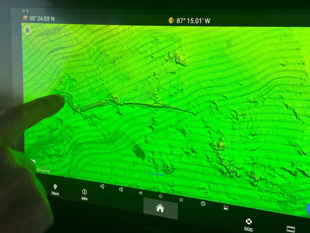
In the two decades since that initial launch, cartography and displays improved exponentially. Satellite and aerial images have become much more broadly available as more imaging companies make higher resolution images readily available. Lower data-storage costs allow higher resolution data, which enables super-fast computing power to show high-resolution bathymetric shading — again improving our ability to see and understand fish-producing bottom structure.
Cartographers have access to higher speed, lower cost data gathering tools. Some have enabled fishermen to record from their own fish finders to supplement bathymetric data that is publicly available.
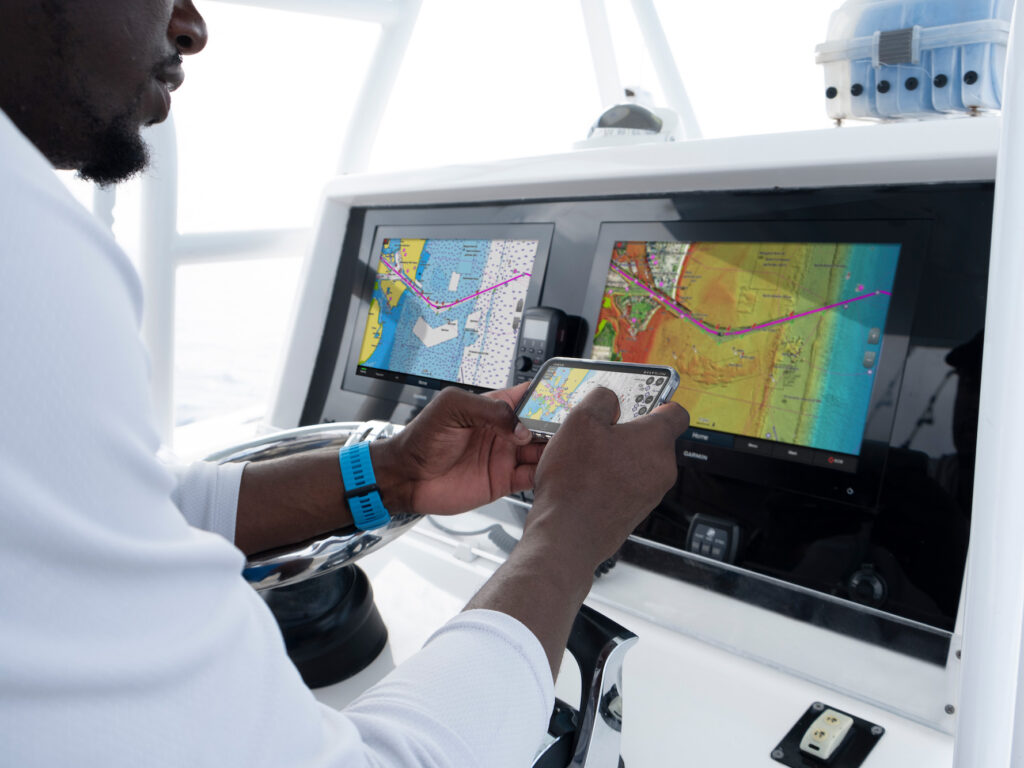
The choices faced by today’s fishermen are vast. If you just navigate from point A to point B using the chart as a guide, you’re going to be in great shape using most any offerings from the big marine-electronics players. If you want the best chance for more fish, you need to study the offerings available locally.
Today’s Fishing Mapping Options
Navionics Platinum+ offers detailed coastal and inland cartography as well as high resolution shaded bathymetric data, satellite images, aerial photos, community edits (very helpful if you visit new places often), dock-to-dock route guidance, and many other features. Garmin bought Navionics in 2017, so non-Garmin units utilize Navionics Platinum+. On Garmin units, Navionics Vision+ is available.
C-Map’s Reveal and Reveal X formats provide the latest, highest-featured offerings, like Navionics Platinum +. Depending on your hardware maker and vintage, you will need to study compatibility tables online to see exactly what you can use.
Humminbird CoastMaster Premium includes region-specific coverage and all the features — plus extras — of Humminbird’s well-known CoastMaster charts. Key additions include 2D shaded relief for bottom detail and depth changes, enhanced aerial imagery to navigate confidently and find fishing spots, auxiliary contours to provide additional contours in shallow waters, and bottom hardness for anglers to identify bottom composition.
CMOR Mapping offers high-resolution data for many areas important for fishing or diving. These are not navigational charts, but they enable outstanding resolution based on surveys with high-resolution echo sounding equipment. I have definitely found bottom features on these charts that I don’t see elsewhere.
Florida and Louisiana Marine Tracks (ISLA Mapping) focus on those two states’ markets. Their high-resolution images provide great clarity for finding fish. These guys have focused particularly on the shallows and ensuring the accuracy of their data so that you can navigate with confidence in shallow water.
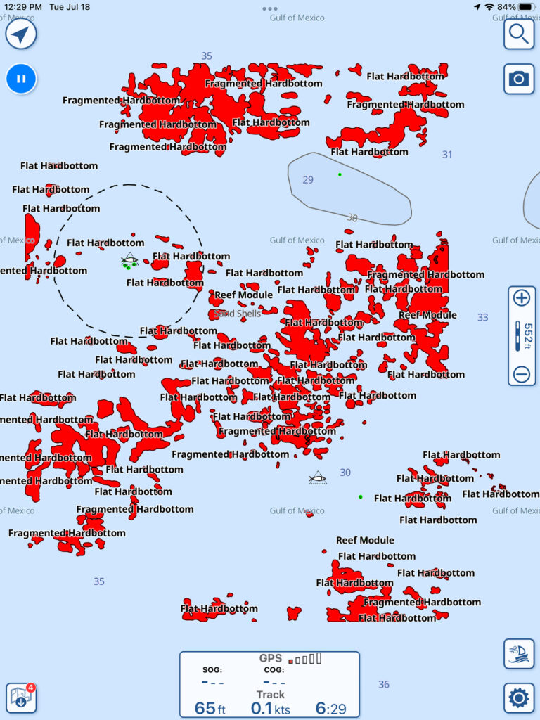
Strike Lines specialize in high resolution charts for finding hard-bottom fishing structure and other areas that typically hold more fish. After starting in the Gulf of Mexico doing custom surveys of fishing areas with high-resolution scanning sonar, they expanded across the US and also have some Caribbean coverage. They offer a variety of products from free digital downloads of public wreck data to customized surveys based on your specific needs.
Standard Mapping provides aerial mapping and 3D relief shading products. This company has limited regions available, but the detail looks very impressive.
Your best resources will be based on the hardware and software you use on your boat or in your planning. There are so many rich options today. Just dive in and start your research for your area and your unique fishing style. Your fishing will improve.
Research and Pre-Fishing Before Hitting the Water
Online sites from our government offer another way to enhance your fishing. NOAA’s Bathymetric Data Viewer is available if you want to geek out on some of the raw data that goes into some of the chart products listed above. You can dive into this tool to do your pre-fishing research. Use publicly available data and viewers to scout areas for new structures.
About the Author: Louis Chemi’s lifelong passion for fishing is deeply rooted in his extensive experience in the marine industry. From his early days fishing in Long Island Sound to his time as a captain and mate on various boats, Chemi has accumulated a vast amount of on-the-water knowledge. With a strong foundation in engineering and marine physics, Chemi has also applied his technical expertise to the fishing industry. He has worked in various roles at Raymarine, Simrad, Lowrance and B&G, including developing fish-finding services and designing marine electronics. More recently, he spent time growing Freedom Boat Club’s franchise business. Today, Chemi continues to explore new fishing waters and share his expertise as a board member of the Recreational Boating & Fishing Foundation.